Forgotten Northwest Mines Sat. 10th August 2024
Our leader has pointed out that the destinations for the day aren’t just along the Blythe River, as previously advertised. One of the mines is on the Bythe River, another is on the Emu River, and there’s even one in Penguin!
We start with the Penguin Silver Mine, which is on the Penguin foreshore and is a short 2-3 minute walk with a small information sign. This one is suitable for all ages and fitness levels.
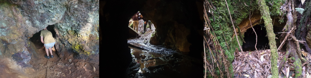
The second mine is the Hampshire silver-lead mine at the end of Silvermine Road. This will require off track walking, climbing down steep slippery slopes, and climbing under and over fallen trees. Care will need to be taken, as there are open shafts of varying depths with the opportunity to enter two of the mines. Walk time is about 30 minutes down to the mines. Suitable for fit walkers and energetic children.
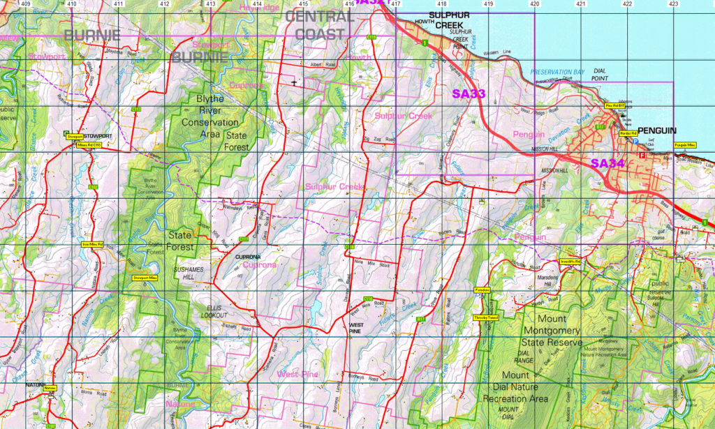
Drive time from Penguin is about 45km (44 min) Following Pine Road (B17) from Penguin, to South Riana, then South Riana Road (C115) to Upper Natone Road (C102), and finally on to Kara Mine Road (name might be different) and forestry tracks. AWD vehicles are advised however a 2WD vehicle would make it too.
After that, if time permits, we will have a look at the iron mines at Stowport on the Blythe River, a drive of 27km (31 mins) from where we parked at Hampshire. This will require a 4×4 to access the track as we will not have time to walk the road to access the river. (If it is dry, AWD SUVs with good clearance, eg RAV, Forester, would get down and out with careful wheel placement). Your leader should be able to shuttle people down if no one else has access to a 4×4. Parking will be on private property close to the start of the 4×4 track. The walk is about 30 minutes to the mine, and is very steep. There are some ropes to help scramble up the unusual rocky outcrop. The top of the rocky outcrop allows views of the Blythe River valley some 100m below. The walk continues up steep open terrain to two small exploratory diggings in the side of another rocky outcrop which is also worth the short scramble to the top. Suitable for fit walkers and energetic children.
Finally, if time permits the mines past Thorsby’s Tunnel (Ellis Tunnel) at Ferndene are worth exploring – a drive of 28km (29 mins) from the Stowport iron mines and only about 5 km from Penguin. This is another off-track adventure following a small heavily mineralized creek. This walk is easy with some climbing over and under fallen trees. Suitable for reasonably agile walkers and energetic children. You will be able to enter Thorsby’s tunnel.
Torches (preferably head torches) are advised. These walks are all short under an hour but the exploring could take some time depending on people’s interest levels.
.Meeting Times and Places:
If you are interested in going on this walk, please phone Darren Wunder on 0438 557 046 to book in. Meet 8:30 am at Hiscutt Park, Crescent Street Penguin by taking the right hand turn straight after the traffic lights if coming from Burnie or off the Bass Highway. A pond and windmill make it easy to spot. Please negotiate any alternative travel arrangements with the leader. You must contact the walk leader per details above if intending to join this walk. The leader should be notified of any other people you intend to bring along. Please be at any meeting place 5 minutes ahead of departure time.
Those coming from Launceston area should meet at Door of Hope southern carpark at 7:00 am. Check with Darren about who to meet there.
To access this area from Burnie: Follow the Bass Highway east from Burnie, turning off at Howth to follow the coastal road to reach the meeting place – 16 km.
If coming from Devonport or Launceston: From Devonport, it’s 22 km via the Bass Highway. An hour and a half from the middle of Launceston (130 km) following the Bass Highway is ample time to make it to Penguin. Take the second exit off the highway, turn right at the traffic lights and the right turn straight after that will get you to Hiscutt Park.
See the walk descriptions above for details about road access to each of the walks. As these are not all tracked and signposted walks, it will be necessary to drive in convoy with Darren from Penguin and to each of the destinations.
Should you wish to meet the party at any of those locations, please check with Darren when registering for the walks.
Equipment and Warnings:
Bring sturdy shoes, head torch, wet/cold-weather gear (It’s still winter, and Tasmania’s weather can vary greatly), plenty of water, lunch and snacks. Optional: trekking poles, gaiters and camera
The following codes [from our 2024 walks calendar] apply:
S Steep incline for at least part of the way
For equipment and safety guidelines, Click Here.
No peakbagger points will be visited on this trip. To find out about these, see The Peakbaggers Points List, which can be downloaded (Excel) from http://tastracks.webs.com/peakbaggers.htm which contains the 1983 and 2000 versions, developed from the original 1968 Hobart Walking Club version. A parallel and more recent but not identical list system is The Abels – also available on the same website, which also contains some other listings of Tasmanian peaks.
For GPX (.gpx) and Google Earth (.kml) versions of the track: Click here to browse our collection.
?????? these links are still to be updated.
GPX version of the track: Click here to download. Google Earth version of the track: Click here to download.
Right-click on the file and save target as to a location of your choice. (Suggest you click the Last modified at top to sort by date to get the most recent at top to find the file for the next walk).