Lake Petrarch Circuit via Byron Gap 21-23 March 2025
CANCELLED – NOT ENOUGH REGISTRATIONS
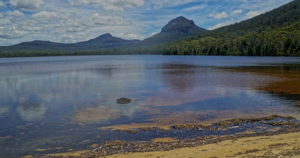
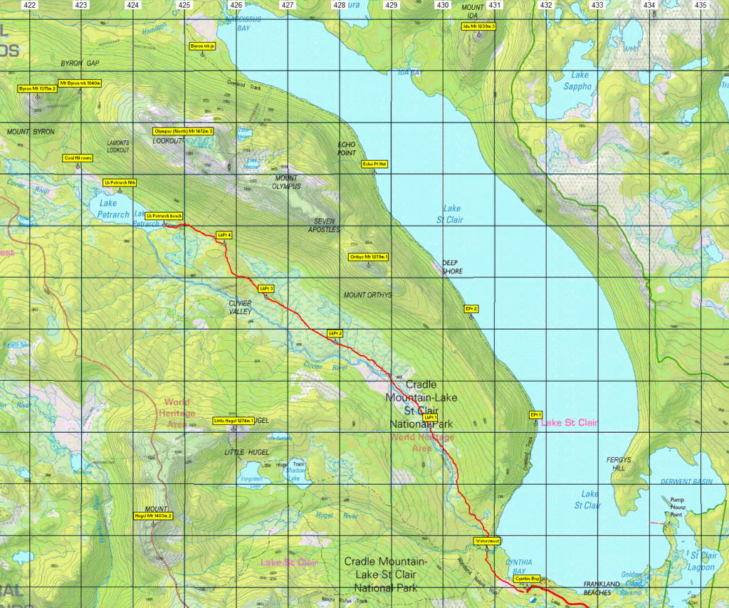
This walk takes us into the heart of the World Heritage wilderness area, and begins from beautiful Lake St. Clair. Over the course of the weekend, the Overland Track will be followed north from Cynthia Bay along the western shore of Lake St Clair for an overnight camp at Echo Point Hut, right on the shore, with morning views on the Saturday directly across to the spectacular Mt. Ida. Continuing northwest, then west and south through Byron Gap, the next camp (tents) will be at the delightful little beach at the south end of Lake Petrarch. The Cuvier valley will then be followed southeast between the impressive heights of Mt. Olympus and Mt. Hugel to rejoin the Overland Track at Watersmeet, just short of Cynthia Bay.
Park entry fees apply – If you are a passenger in a car with a Parks sticker, you are covered by the driver’s Parks registration. See www.parks.tas.gov.au/?base=1558 for a more detailed description. This walk is rated medium-hard due to the distances, a steep climb and the need to carry a heavier pack with camping gear, and is suitable for experienced walkers who are familiar with uneven tracks, button grass vegetation and exposed alpine conditions.
Day 1: Departing Launceston at 4:00pm and driving to Cynthia Bay (Lake St Clair), ready to start walking at about 6:30pm. It is approximately 10 km walk to Echo Point hut, and at this time of day, most of it will be walked in darkness, so head torch and spare batteries essential. The track is obvious, but often uneven under foot.
Day 2: Continue northwest along the shore of Lake St Clair, turning off to the left at the Byron Gap junction at just under 5 km. The Byron Gap track is steep, quite vague and sparsely marked and requires walkers to pay careful attention. It climbs steadily west for about 3 km to reach Byron Gap, alt. 1040m, a gain of about 200m. Continue about 4 km south, then southeast, descending to the shore of Lake Petrarch, then to the beach at the eastern end of the lake. The walk alongside Lake Petrarch is very overgrown, and may require some significant scrub-bashing. Tent camping at this delightful spot with views of Mts. Byron and Cuvier to the north. About 12 km for the day, mostly on an uneven, steep and difficult track.
Day 3: Follow the Lake Petrarch track southeast for 10 km, rejoining the Overland Track about 1 km from Cynthia Bay. While there is a gradual drop in altitude, conditions vary from fairly open bushland to extensive buttongrass, which can be tedious to walk through. The track in this valley has not been maintained and is completely overgrown (ie, non-existent) for much of its length, so be prepared for less comfortable walking, but enticed by the comforts of civilisation at the visitor centre cafe.

Meeting Times and Places:
If you are interested in going on this walk, please phone or text your leader, Nik Sands, Ph. 0429 387 777 by 20th March to book in. Nik needs you to let him know as soon as possible to make sure the party is viable.
Important! Online Registration is required for this walk! SU safety regulations require completion of an online registration form for all Boots N’ All overnight camping trips. Register at: Boots N’ All Lake Petrarch Circuit – March 2025 – SU Australia | Brushfire
You must still contact Nik, however, to confirm that this is the right walk for you.
The departure time is 4:00 pm on Friday 21st March from the Door of Hope Church car park, Launceston. The alternative meeting places are Perth, Longford or Cressy or Poatina (please arrange with Nik ahead of time). Please be at any meeting place 5 minutes ahead of departure time. For most Boots N’ All walks, including all wilderness trips, it is essential to contact the walk leader per details above if intending to walk. The leader should be notified of any other people you intend to bring along.
To access this area from northern Tasmania: From Launceston, follow southern outlet and Midland Highway A1, taking off-ramp to B52 just past Perth to Longford, then B51 through Longford and Cressy, past Poatina, continuing up the mountain and south past Great Lake to reach the junction of Highland Lakes Road B5, about 97 km from Launceston. Turn right and continue 15km west and northwest on A5 through Miena to reach Marlborough Rd. B11. Turn left and follow through this gravel road, past Bronte Park to the Lyell Highway A10 (about 30 km). Turn right, and head another 30 km west to Derwent Bridge. Just across the bridge, turn right into Lake St. Clair Rd. C193 and another 5 km will bring you to Cynthia Bay and the Lake St. Clair car park.
Alternatively, you might arrange with the leader to meet at Lake St. Clair, and from Launceston, head towards Deloraine on the Bass Highway (50 km) and take the first (eastern) turn from the highway into Deloraine. Continue into the town and turn left immediately before the bridge. From Deloraine, head south along the “Lake Highway” A5 – now Highland Lakes Rd. (but the first bit may be called Meander Rd!). Make sure to turn left after 7 km at signposted junction for Highland Lakes Rd. Continue south on A5 through Golden Valley, up past Quamby Bluff and Projection Bluff, and south along the western side of Great Lake. 52 km from the junction and 59 km from Deloraine, you pass through Liawenee, and continue another 9 km south to junction of Marlborough Rd. Turn right and follow per above. Cynthia Bay is about 128 km from Deloraine, and 178 km from Launceston using that route.
It’s slightly shorter at 172km using the Poatina route per above. Allow 2hrs 20 min driving by either route.
Warnings:
The following codes [from our 2025 walks calendar] apply:
D Drive distance requires early departure
S Steep incline for at least part of the way
L A long days walk in excess of 3 hours each way
M Marshy or muddy sections – be prepared to walk with wet feet.
E Exposed alpine conditions ; can be dangerous in poor weather if not adequately equipped.
Click this link for a more detailed discussion of Preparation, Food and Safety guidelines for Boots N’ All walks.
Map details:
Lake Petrarch area: 1:100000 map is Nive (8113) and 1:25000 map is Olympus (4234).
Map reference: na
No peakbagger points will be visited on this walk, but waypoints with altitude and point ratings of nearby peaks are included in the gpx and kml files. See Peakbaggers List 2017, which can be downloaded (Excel) from Peak Baggers and The Abel Mountains | Hobart Walking Club. At the time of writing, the website to which we used to link has been taken down, along with the 1983 and 2000 versions, developed from the original 1968 Hobart Walking Club version. We can’t guarantee that peaks you have bagged in the past are still on the current version. You can download the 2000 version from our website here [link]. A parallel and more recent but not identical list system is The Abels – also linked from the HWC website, which also contains some other listings of Tasmanian peaks.
For GPX (.gpx) and Google Earth (.kml) versions of the track: Click here to browse our collection.
Direct links: GPX for this walk KML for this walk
Right-click on the file and save target as to a location of your choice. (Suggest you click the Last modified at top to sort by date to get the most recent at top to find the file for the next walk).

