POSTPONED! KENT HAS CALLED OFF THIS SATURDAY’S WALK DUE TO POOR WEATHER FORECAST. Hopefully to be rescheduled for later in the year.
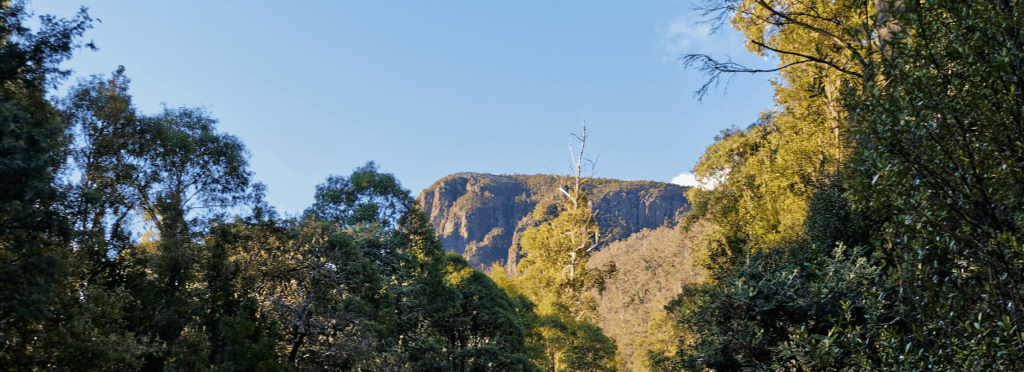
With shortening days and winter approaching, and with large areas of the central plateau again closed for deer culling, we can still do a shorter, but still spectacular, walk via the Walls of Jerusalem access track, to a point high above Lake Rowallan.
Walk route:
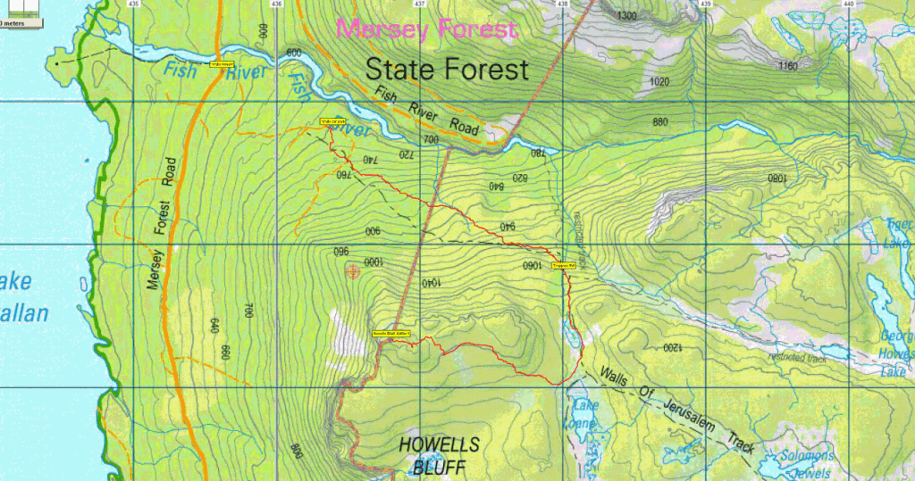
The walk begins with a fairly demanding ascent from the car park (alt. 700 metres) eastward to the plateau (about 500 metres altitude over about 3 km distance). Once past Trappers Hut, the incline eases, and becomes relatively flat over the next km, first south, and then west. Over the final 1.5 km or so, some altitude will be gained to reach the summit of Howells Bluff (alt. 1245m), 500m higher than the carpark. The descent may take a direct route north to rejoin the Walls track, less than 1 km from the summit, so quite steep! Much of the walk is off-track, so walking boots and gaiters are strongly recommended. Overall distance is about 10 km.
This walk is rated “medium” and is suitable for walkers who have had some experience with steep and rocky tracks as well as off-track alpine walking. Energetic older children should manage well. Not suitable for those heavily dependent on walking sticks. Because of the exposed alpine conditions, walkers must be fully prepared for poor weather, no matter what the forecast is. Please see the warnings below.
Meeting Times and Places:
If interested in going on this walk, please phone or text your walk leader, Kent Lillico on 0428 451 528 to book in. The departure time is an early 7:30 am from Launceston, with Kent meeting the party at the Mole Creek toilet block at 8:30 am.
If you would like to arrange to meet the group at these places or elsewhere, please arrange with the leader, and please be at any meeting place 5 minutes ahead of the listed time.
The leader should always be notified of any other people you intend to bring along, especially for a demanding walk like this one, and you should always contact the walk leader if intending to participate in a particular Boots N’ All walk.
To access this area from northern Tasmania: proceed along the Bass Highway to Deloraine (about 51 km), but do not turn off at the eastern exit into Deloraine. Instead, continue across Meander R. and up hill to the western exit, and to the roundabout at start of Mole Creek Rd. A further 24km will bring you to Mole Creek (sometimes used as a meeting place for our walks – check with leader). Continue west past Mole Creek, on what is now Liena Rd, making sure you turn south at the caravan park 4 km from the town. The road continues west until about 14 km from Mole Creek, it branches south, now called Mersey Forest Road. A little over 6 km south, you will pass turnoffs to Cradle Mountain and Devil’s Gullet (Lake Mackenzie) but keep going south, crossing the Mersey at Lake Parangana and passing the turnoffs for Bare Hill and Arm River. Another 17 km should see you cross below the Rowallan Dam. Continue south along the east side of Lake Rowallan, for a little over 5 km, and about 100 metres past the Fish River bridge, you will see the Walls of Jerusalem on the left. Follow this road for 1 km to reach the car park and the beginning of the Walls of Jerusalem walking track.
Warnings:
The following codes [from our 2025 walks calendar] apply:
D Drive distance requires early departure
S Steep incline for at least part of the way
M Marshy or muddy sections be prepared to walk with wet feet.
E Exposed alpine conditions ; can be dangerous in poor weather if not adequately equipped.
Click this link for a more detailed discussion of Preparation, Food and Safety guidelines for Boots N’ All walks, and especially preparation for exposed alpine conditions.
Map details & References:
Howells Bluff: 1:100000 map is Mersey (Tasmap 8114) and 1:25000 map is Rowallan (Tasmap 4237)
(Short ref. 368732)
Zone Easting Northing Latitude Longitude
55G 4 36 800 53 73 330 -41.78937 146.23938
Howells Bluff is worth 1 Peakbagger point. For explanation of this challenge, see Peakbaggers List 2017, which can be downloaded (Excel) from Peak Baggers and The Abel Mountains | Hobart Walking Club. At the time of writing, the website to which we used to link has been taken down, along with the 1983 and 2000 versions, developed from the original 1968 Hobart Walking Club version. We can’t guarantee that peaks you have bagged in the past are still on the current version. You can download the 2000 version from our website here [link]. A parallel and more recent but not identical list system is The Abels – also linked from the HWC website, which also contains some other listings of Tasmanian peaks.
For GPX (.gpx) and Google Earth (.kml) versions of the track: Click here to browse our collection.
Direct links: GPX for this walk ¦ KML for this walk
Right-click on the file and save target as to a location of your choice. (Suggest you click the Last modified at top to sort by date to get the most recent at top to find the file for the next walk).