Magnet and Cleveland Mines Sat. 22nd August 2026
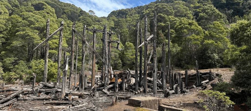
In 2024, Darren took us to explore several abandoned mines in the hinterland south of Penguin and Burnie. This time, it’s even further west – two former mines near Waratah. We will be exploring the old Magnet tin mine mill, an adit, the explosives storage, tramway, school site and a Canadian redwood planted about 100 years ago by the school students. Then off to the Cleveland mine and mill site a few km further southwest, around 100 years old as well.
The actual walking is fairly short – only a few hundred metres between each of the features, and of course driving from Magnet to Cleveland. It will still require moderate fitness and energy to keep with the group. Suitable for energetic children, regular bushwalkers and the semi-retired ones who can still manage shorter walks. Note that the Cleveland mill site is extremely steep, and a rope may be needed to assist access.
August is still winter, and the weather can be very variable in west of Tasmania. The Waratah area is subject to plenty of rain and showers, so make sure you carry warm clothes and a raincoat, as well as wearing sensible and robust footwear. No scrub this time, so gaiters are less necessary.
Meeting Times and Places:
If you are interested in going on this walk, please phone Darren Wunder on 0438 557 046 to book in. Meet 7:45 am at Hiscutt Park, Crescent Street Penguin by taking the right hand turn straight after the traffic lights if coming from Burnie or off the Bass Highway. A pond and windmill make it easy to spot.The alternative meeting place is Ridgely service station at 8:20 am (leave at 8:30) or Waratah if coming via Sheffield. Please negotiate any alternative travel arrangements with the leader. You must contact the walk leader per details above if intending to join this walk. The leader should be notified of any other people you intend to bring along. Please be at any meeting place 5 minutes ahead of departure time.
Accommodation offer! Darren has room to accommodate several people overnight if driving that far in the morning seems a bit daunting. Contact him directly on 0438 557 046 if you want to take up that generous offer.
To access Magnet Mine from Burnie: Head south via Mount St and Ridgley Hwy/B18 to reach Ridgley, the alternative meeting place (12.5 km). From Ridgley, continue a further 42 km south along Ridgley Hwy to reach the Waratah junction. Turn right into Waratah Rd. (B23) and continue 7km to reach Waratah. Turn left to continue along Waratah Rd. for a further 12km to reach Magnet Rd. Turn right and follow Magnet Rd. (gravel) 5km north and NE to reach the Magnet Mine site.
To reach the Cleveland town and mine site, return the 5 km to Waratah Rd, then turn right and continue a further 4.5km west (sealed but lots of bends).
Allow 1 hour from Penguin to Waratah.
If coming from the Launceston area, allow 2hrs 15min if going via Burnie and Ridgley Hwy to reach Waratah, or 2 hrs 20 if going via Sheffield and Belvoir Rd. If coming via Cradle Mt – Belvoir Rd, turn right when reaching the Murchison Hwy and head north 16.5km to reach Waratah Rd. Meet at Door of Hope at 6:30 am.
Equipment and Warnings:
Bring sturdy shoes, wet/cold-weather gear, plenty of water, lunch and snacks.
The following codes [from our 2025 walks calendar] apply:
D Drive distance requires early departure – 6:30 am if coming from Launceston.
Winter bushwalking can be dangerous in poor weather if not adequately equipped; Click Here for some guidelines.
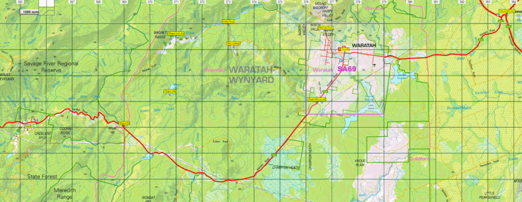
Map details: For both locations, 1:100000 map is Tasmap 7915 (Arthur River)
Magnet mine: 1:25000 map is 3641 (Waratah) Approx. location 41.457107 S, 145.444674 E
Easting, Northing 500298, 5410225, Zone 55G
Cleveland mine: 1:25000 map is 3640, (Luina). Approx. location 41.479352 S, 145.3840E
Easting, Northing 495121, 5406189, Zone 55G
No peakbagger points will be visited during this walk. For explanation of peakbagging, see our new Peakbaggers and Abels page, which has links to various lists of peaks, including Peakbaggers, Abels, Poimenas and others. For really enthusiastic walkers, Phil Andrew’s recently updated Tasmanian Peaks Composite List [link] can be downloaded, which gives a complete smorgasbord of Tasmanian mountains, hills and high places – enough for a lifetime of bushwalking!
For GPX (.gpx) and Google Earth (.kml) versions of the track for this walk: Click here to browse our collection.
No gpx tracks available for this walk. The linked files contain only waypoints – still useful!
Direct links: GPX for this walk — KML for this walk
Click here to learn about using your phone as a navigation device, or to find out about handheld GPS devices.