Devonport Goldmine & Black Bluff East – Sat. 3rd Oct. 2026
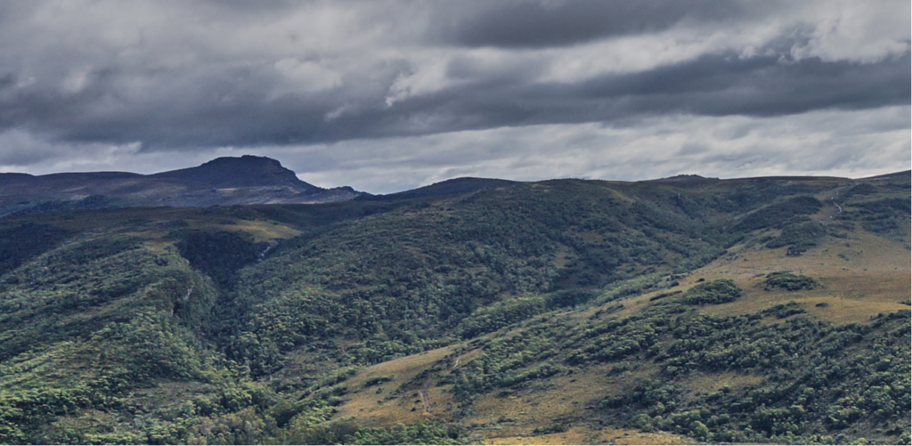
A “first” for Boots N’ All as far as we know, the former Devonport Goldmine is on the eastern flank of Black Bluff East, itself above the track to Winterbrook Falls, visited on more recent Boots N’ All walks. Apart from the interest of visiting a more or less forgotten goldmine with a confusing name (it’s nowhere near Devonport!), the track passes over the shoulder of Black Bluff East, and should give great views of Black Bluff itself, and a panoramic vista across the northwest region.
Walk Route
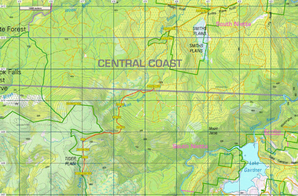
The walk begins from old logging roads south of South Nietta. After 1km of fairly flat walking to the west, it turns south and begins to climb steeply, gaining 250m over the next km, before again turning west. A further 60m is gained before the track levels out over the next 1.5km. Turning south again, a little over 1 km of descent (150m) brings us to the remains of the mine alongside Devonport Creek. Total walk distance is 9.5km return. While steep, the entire mine walk is on old logging tracks. If time permits and the party has made good time, a visit to the summit of Black Bluff East might be possible on the return journey. This would add an extra 2km to the distance, but only an extra 50m altitude from the highest point of the main track. Again, this has a vehicular track of sorts to follow. Due to the steep ascent and distance, the walk is rated as medium-hard, and requires moderately good fitness. Energetic older children should enjoy the walk.
Meeting Times and Places:
If you are interested in going on this walk, please phone or text the walk leader, Peter Davies on 0414 516 268 to register. The departure time is 6:30 am from Door of Hope carpark in South Launceston. Suggested meeting place for northwest walkers is at Nietta (junction of C128 and C129) at 8:30am. If you would like to arrange to meet the group at these places or elsewhere, please arrange with the leader, and please be at any meeting place 5 minutes ahead of the listed time.
The leader should always be notified of any other people you intend to bring along, and you should always contact the walk leader if intending to participate in a particular Boots N’ All walk.
To access this area from northern Tasmania: From Launceston, proceed along the Bass Highway, through Devonport, to Ulverstone – 120 km. Turn off the highway at the exit to Gawler (B17). Continue south about 1.5 km and take the right branch at Gawler. Continue on B17 for just under 8 km, then left into Preston Road, C125, continuing through Preston and South Preston to Nietta.
Alternatively, Google Maps suggests from Gawler, take Top Gawler Rd (C123) to Sprent, then turn right into Castra Rd. Follow Castra Rd. (B15) to Nietta – just under 29 km from Gawler. This may be the preferable route. Continue south for 4.5km on South Nietta Rd (C129) to reach South Nietta.
At South Nietta, take the left fork and continue south on Smiths Plains Rd (C129), and follow the road as it swings right, continuing a further 6 km through old logging roads to reach a junction that is likely signposted for Winterbrook Falls. Keep left at this junction, and continue south for 1.7km to reach a junction where cars will be parked and the walk begins. Allow about 2 hours drive from Launceston.
Warnings:
S Steep incline.
E Exposed alpine conditions – can be dangerous in poor weather if not fully equipped – see below.
You should carry wet weather gear as well as warm clothing in case of sudden weather changes. Walkers should carry water with them, suggest 1 litre. Also bring your lunch and snacks.
Bushwalking can be dangerous in poor weather if not adequately equipped; For equipment guidelines, Click here.
Map details:
Black Bluff East: 1:100000 map is Forth (Tasmap 8115) and 1:25000 map for upper area is Lea (TasMap 4040).
Map reference:
Short ref. n/a
Zone Easting Northing Latitude Longitude
55G 4 16 730 54 09 820 -41.458889 146.002946
No Peakbagger peaks will be visited on this walk. For explanation of this challenge, see our new Peakbaggers and Abels page, which has links to various lists of peaks, including Peakbaggers, Abels, Poimenas and others. For really enthusiastic walkers, Phil Andrew’s recently updated Tasmanian Peaks Composite List [link] can be downloaded, which gives a complete smorgasbord of Tasmanian mountains, hills and high places – enough for a lifetime of bushwalking!
For GPX (.gpx) and Google Earth (.kml) versions of the track for this walk: Click here to browse our collection.
Direct links: (route to Devonport Goldmine) GPX for this walk … KML for this walk