Mt. Blackwood – Sat. 24th October 2026
As far as we can work out, there has never been a Boots N’ All walk to Mt. Blackwood – certainly not in the past 10-15 years. Situated at the top of the Poatina Highway, it is on the northern face of the Great Western Tiers, offering extensive views across the north of the state.
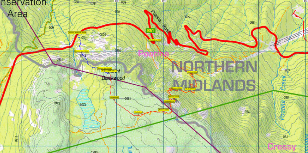
Walk Route: The route begins from the final sharp zig-zag on Poatina Rd, and at first heads southeast for about 1.5km of relatively level walking along an old construction road, before swinging south and then west, rising very steeply through a series of short zig-zags and gaining 300 metres over not much more than 1 km, even less “as the crow flies”. Reaching the escarpment gives relief from the steepness. The route continues west for about 1 km, then northwest and north for about 1.5km to reach the summit, altitude 1336m. The walk is rated medium, but the unrelenting steep ascent requires moderately good fitness to allow the party to move at a reasonable pace. The return trip is just under 11km, although there is a possibility of a much shorter return to the highway north of the summit. Energetic and resilient older children should manage this well.
Meeting Times and Places
If you are interested in going on this walk, please phone or text the walk leader, Peter Davies on 0414 516 268 to register. The departure time is 7:30am from Door of Hope car park in Launceston. If you wish to meet with the group at any other place, please arrange with the leader. However, you still need to contact the walk leader, if intending to walk. The leader should be notified of any other people you intend to bring along. Please be at any meeting place 5 minutes ahead of departure time.
To access this area from northern Tasmania:
From Launceston, head south on the Midland Highway for 18 km, keeping an eye out for the B52 exit on left as you begin to pass Perth. Follow B52 for 4.5km to the Longford roundabout, continuing into Longford, then through Longford, swinging right to Cressy Rd. B51. Continue for 11 km to Cressy, and through Cressy, continue south another 7.5km and turn right into Poatina Rd. Follow Poatina Rd. for 28 km, past the Palmerston switchyard, past the Poatina turnoff, and up the switchbacks to almost reach the top of the Great Western Tiers. As mentioned, the start of the walk is at the final hairpin bend in the road, about 300 metres short of a side road on the left that goes up to the headrace tunnel.
Warnings:
The following codes apply from our 2026 walks calendar:
E Exposed alpine conditions – can be dangerous in poor weather if not fully equipped – see below.
S Steep incline for at least part of the way
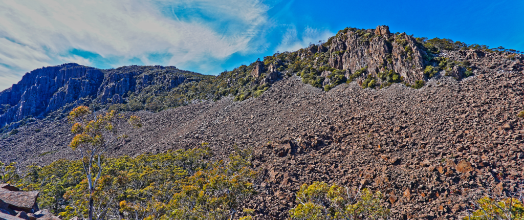
B Boulder field – walkers need to be able to confidently step from rock to rock (if short route is followed – see photo).
Please carry lunch and snacks and plenty of water. Walkers are advised to wear strong shoes or boots. Gaiters are recommended due to scrubby patches. Even in warm seasons, you should always carry wet weather gear as well as warm clothing including gloves and beanies in case of sudden weather changes. The destination of this walk is over 1000 metres altitude, and can be very exposed if the weather turns bad. Be prepared!
Click this link for a more detailed discussion of Preparation, Food and Safety guidelines for Boots N’ All walks.
Map details:
Mt Blackwood: 1:100000 map is Tasmap 8214 (Meander) and 1:25000 map is 4837 (Poatina)
Map references: (short ref. 898704)
Zone Easting Northing Latitude Longitude
55G 4 89 840 53 70 540 -41.81695 146.87767
Mt. Blackwood is worth 1 peakbagger point. For explanation of this challenge, see our new Peakbaggers and Abels page, which has links to various lists of peaks, including Peakbaggers, Abels, Poimenas and others. For really enthusiastic walkers, Phil Andrew’s recently updated Tasmanian Peaks Composite List [link] can be downloaded, which gives a complete smorgasbord of Tasmanian mountains, hills and high places – enough for a lifetime of bushwalking!
For GPX (.gpx) and Google Earth (.kml) versions of the track for this walk: Click here to browse our collection.
Direct links: GPX for this walk … KML for this walk