40 Lakes Pk & Lake Nameless – Sat. 10th 17th Jan. 2026
NOTE – FURTHER CHANGE! PHIL DAWSON WILL NOW LEAD – SEE BELOW FOR CONTACT DETAILS
Due to unforseen circumstances, Kent is no longer able to lead this walk, and Phil Dawson has kindly taken it on.
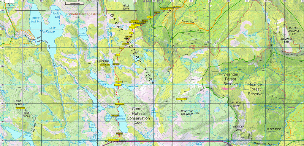
Note that the walk will now follow Western Creek track from Westrope Road – approx. 1km further up from the Dale Brook Rd turnoff, there is a marked turnoff to the Western Creek carpark.
After reaching the plateau escarpment, the walk heads south past Whiteleys Hut to follow the western shore of Lake Ironstone before branching southwest for about 2km to reach Lake Nameless Hut and the foot of Forty Lakes Peak. Distance about 8.5km each way – about 1km shorter overall, and starting at a much higher altitude, so a little kinder, but still needing good fitness and experience, and the stamina to move at a good pace.
See also new map image below, and new links for gpx and kml track files.
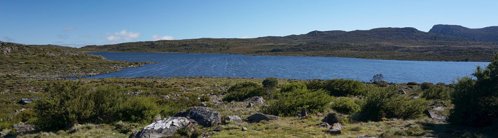
High summer is a great time to head deep into the Central Plateau. The wildflowers should still be spectacular, and the wide open spaces seem to go on for ever. This walk takes you up Higgs Track, past Lady Lake (well known for its comfortable hut), and then south into a land of lakes and peaks and areas of open alpine vegetation. Sights should include Panorama Hill, Lake Lucy Long and Lake Weston with views east to Mt. Ironstone and south to Forty Lakes Peak.
Walk Route:
The climb from the car park to Lady Lake rises 500 metres over about 2 km on a well-formed but steep track. Heading south past Lady Lake Hut, the track rises a further 90m over the next km or so before levelling out at about 1200 metres for the continuation south towards Lake Nameless. 3.5 km from the hut will bring you to Lakes Lucy Long and Weston on either side of the track, with a little over 1 km further to the northern end of Lake Nameless.
Ironstone Hut is the next goal, at the southern end of the lake, nestled under Forty Lakes Peak, 6.5km from Lady Lake and a little under 2 km from the northern end of the lake.
If time, weather and energy levels permit, the peak itself – only 400 metres further on, but a rocky scramble to gain 100m altitude, would be the ultimate destination. The return trip follows the same route. Due to the distances, this walk is rated medium-hard, and should only be attempted by well-equipped, fit and energetic walkers who are familiar with alpine track conditions. Walkers must be fully prepared for poor weather. Please see the warnings below.
Meeting Times and Places:
If you are interested in going on this walk, please text Phil Dawson on 0417 527 511 or email pidasms@gmail.com to book in.Changed from Kent Lillico, ph. 0428 451 528 to book in.
The departure time is 7:00 am from the Door of Hope Church car park, Launceston. Suggested meeting places if coming from elsewhere are at the Deloraine train park at 7:35 am or Dale Brook Rd. turnoff at 8:00 am. If you would like to arrange to meet the group at these places or elsewhere, please arrange with the leader, and please be at any meeting place 5 minutes ahead of the listed time. The leader must be notified of any other people you intend to bring along.
To access this area from northern Tasmania: From Launceston, proceed along the Bass Highway to Deloraine (about 51 km). Follow the off-ramp into Deloraine and when crossing the bridge, turn right at roundabout to enter the “train park” car park. (If you were not meeting the group there, you would not turn off at the eastern exit into Deloraine. Instead, continue across Meander R. and uphill to the western exit, and to the roundabout at start of Mole Creek Rd.) After leaving the train park, follow the main street uphill through Deloraine to reach the large roundabout. Turn left into Mole Creek Rd. and go about 8 km before turning left into Dairy Plains Rd. Go all the way through Dairy Plains Rd. (several right hand turns and 2 junctions where you need to follow the signs). When you arrive at the T junction with Western Creek Rd, turn right and 800m further on, turn left up Westrope Rd. Go more or less straight for 4 km south, to reach the junction of Dale Brook Rd. which turns off to the right. The car park for the walk is about 500 metres from Westrope Rd. Westrope Rd. is all gravel, and somewhat degraded in parts, but should be accessible for 2WD vehicles with reasonable clearance.
Warnings:
The following codes [from our 2026 walks calendar] apply:
M Marshy or muddy sections – be prepared to walk with wet feet.
S Steep incline for at least part of the way
E Exposed alpine conditions ; can be dangerous in poor weather if not adequately equipped.
Click this link for a more detailed discussion of Preparation, Food and Safety guidelines for Boots N’ All walks.
Map details:
Western Creek/Higgs Track area: 1:100000 map is Mersey (Tasmap 8114) and 1:25000 map for the area is Lake Mackenzie (TasMap 4438).
Forty Lakes Peak: 1:100000 map is Mersey (Tasmap 8114) and 1:25000 map for the area is Pillans (TasMap 4437).
Forty Lakes Peak short ref. 527798
Zone Easting Northing Latitude Longitude
55G 4 52 870 53 79 940 -41.73095 146.43330
Forty Lakes Peak (not an Abel) is worth 1 peakbagger point. For explanation of this challenge, see Peakbaggers List 2017, which can be downloaded (Excel) from Peak Baggers and The Abel Mountains | Hobart Walking Club. At the time of writing, the website to which we used to link has been taken down, along with the 1983 and 2000 versions, developed from the original 1968 Hobart Walking Club version. We can’t guarantee that peaks you have bagged in the past are still on the current version. You can download the 2000 version from our website here [link]. A parallel and more recent but not identical list system is The Abels – also linked from the HWC website, which also contains some other listings of Tasmanian peaks.
For GPX (.gpx) and Google Earth (.kml) versions of the track: Click here to browse our collection.
Direct links: (route via Western Ck track) GPX for this walk … KML for this walk
Right-click on the file and save target as to a location of your choice. (Suggest you click the Last modified at top to sort by date to get the most recent at top to find the file for the next walk). (Higgs Track route: GPX for this walk … KML for this walk)
New route:

old route